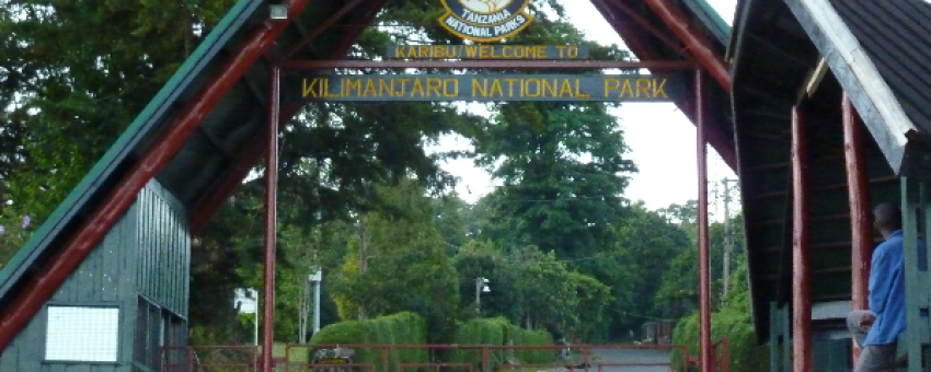
6 DAY RONGAI ROUTE KILIMANJARO CLIMB
Rongai route
This non-technical Kilimanjaro camping route is the only one to start from the Northern side of the mountain. Rongai approaches the main Kilimanjaro (Kibo) cone from the Northeast which usually is drier (helping avoid rainfall) and descends via the Marangu route on the Southeast. Though we consider this less physically demanding than other routes (no scrambling sections as you get on the southern circuit routes), short treks do not offer acclimatization opportunities and the easier walk may catch up with you at the higher altitudes.
Points forts du séjour
Pendant votre séjour vous pourrez profiter des points forts suivants : Culture / Patrimoine, Faune et flore, Voyage nature, Séjour multi-destination, Voyager seul et voyager en groupe.
Meilleurs mois pour partir
La/les meilleure(s) période(s) pour partir est/sont : Janvier, Février, Juillet, Août, Septembre, Octobre.
Comment se rendre sur place ?
Vous pouvez vous rendre sur place en , Voiture.
SHAH TOURS
De 1800€ à 2525€ / personne
Voyage adapté pour :
Détail du séjour : 6 DAY RONGAI ROUTE KILIMANJARO CLIMB - 6 jours
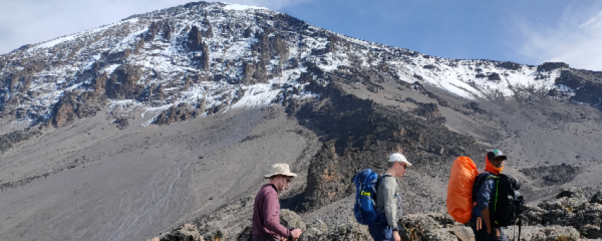
Moshi town to Rongai gate to Simba (First Cave) Camp
© Shah Tours
Etapes : Moshi
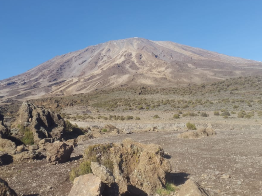
You will be transferred by road from Moshi town (09:00am) to Rongai gate. After registration you begin your trek through the rain forest zone with your guide. The forest thins out quickly on this remote and drier side of the mountain and you reach your camp on the edge of the forest and heather zone near the caves.
Approx. driving distance: 2-3 hours
Approx. trekking distance: 8km or 5mi (4-5 hours)
Start altitude: 2020m or 6630ft
End altitude: 2625m or 8610ft
Highest Altitude reached: 2625m or 8610ft
Altitude +gain / -loss: +605m or 1980ft
Meals included today: Picnic lunch, dinner
Overnight at Simba (First Cave) Camp
Simba (First cave) Camp to Kikelelwa Cave Camp
© Shah Tours
Today’s hike takes you further up towards the Kibo cone and into the lower alpine heather & moorland zone through a more barren landscape than the day before and heading past the second group of caves near the Second cave camp where you may stop for lunch. From the second group of caves you divert southeast heading towards the jagged Mawenzi peaks. You stop near the Kikelelwa caves for your nights camp.
• Approx driving distance: None
• Approx trekking time: 7-9 hours
• Approx trekking distance: 12km / 7.5mi
• Start Altitude: 2625m or 8610ft
• End Altitude: 3630m or 11910ft
• Highest Altitude reached: +1005m or 3300ft
• Altitude +gain / -loss: +855m or 2810ft
• Meals included: Breakfast, picnic lunch or lunch, dinner
Style: Shared Public campsite
Location: Heather & moorland, Kilimanjaro National Park
Altitude: 3630m or 11910ft
Overnight at Kikelewa Cave Camp
Kikelelwa Cave Camp to Mawenzi Tarn Camp
© Shah Tours
Today’s hike is a short and steep one through a grassy slope and into the alpine desert. You continue your movement south-east towards the Mawenzi cone where the landscape dramatically changes. Your camp for tonight is inside of the Mawenzi ridge and near the tarn lake. You can also optionally venture out further with your guide for acclimatization walks.
• Approx driving distance: None
• Approx trekking time: 5-7 hours
• Approx trekking distance: 5km / 3mi
• Start Altitude: 3630m or 11910ft
• End Altitude: 4310m or 14140ft
• Highest Altitude reached: 4390m or 14400ft
• Altitude +gain / -loss: +760m or +2490ft / -80m or -260ft
• Meals included: Breakfast, picnic lunch or lunch, dinner
Style: Shared Public campsite
Location: Alpine desert, Kilimanjaro National Park
Altitude: 4310m or 14140ft
Overnight at Mawenzi Tarn Camp
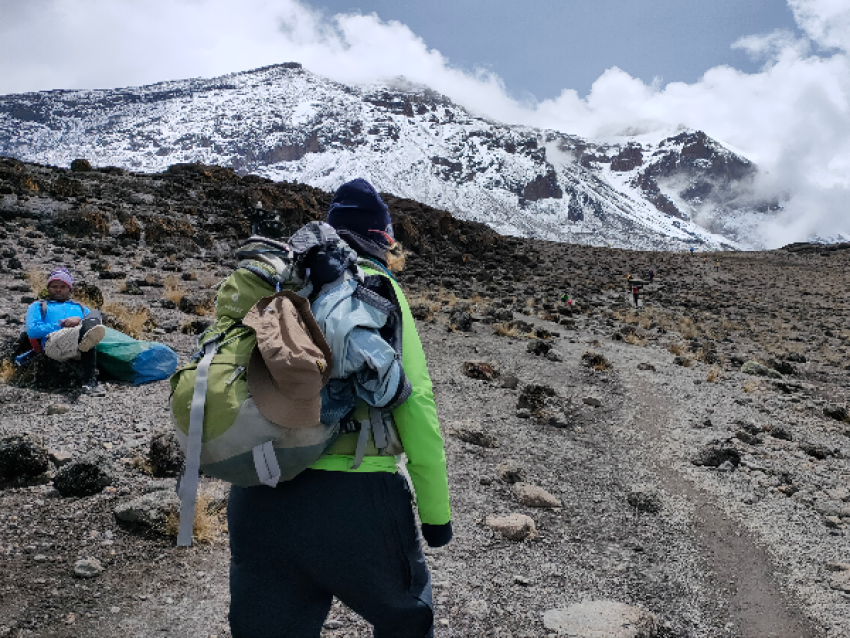
Mawenzi Tarn Camp to School Hut Camp (or alternatively Kibo Camp)
© Shah Tours
Your hike today takes you back towards the Kibo cone steadily climbing up and over the edges of the alpine desert journeying through the ‘saddle’ between the Kibo and Mawenzi peaks. The environment becomes more barren and air thinner as you ascend to your base camp where you will rest for the summit journey starting tonight.
• Approx driving distance: None
• Approx trekking time: 4-5 hours
• Approx trekking distance: 8km or 5mi
• Start Altitude: 4310m or 14140ft
• End Altitude: 4715m or 15470ft
• Highest Altitude reached: 4715m or 15470ft
• Altitude +gain / -loss: +405m or +1330ft
• Meals included: Breakfast, picnic lunch or lunch, dinner
Style: Shared public campsite
Location: Alpine desert, Kilimanjaro National Park
Altitude: 4715m or 15470ft
Overnight at School Hut Camp
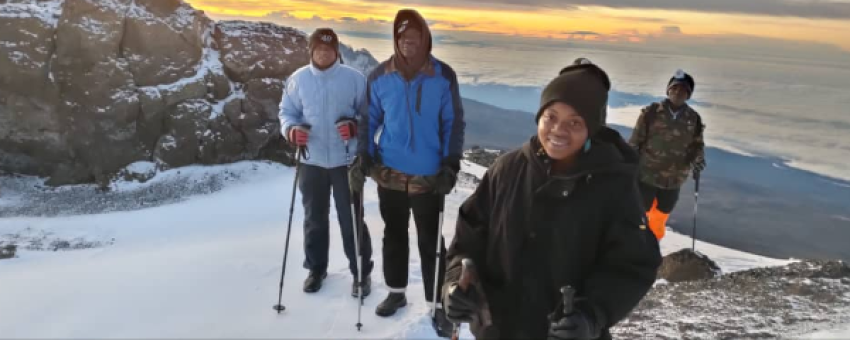
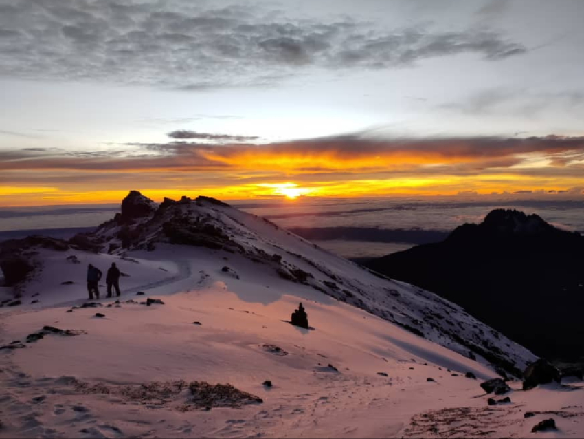
School Hut Camp to Gilman’s point to Uhuru peak to Horombo Hut Camp
© Shah Tours
In the early morning (around 00:00am) you begin your final ascent to the summit of Uhuru peak through the arctic zone. The trek is a steep hike over loose volcanic scree through the dark and cold night and takes a slow pace in a zig-zag pattern towards Gilman’s Point (5681m or 18640ft) which is your first stop on the Kibo crater rim. From here a short (but difficult) hike remains to take you past Stella point (the first stop on the rim for those summiting from Barafu camp / the Southern circuit) and further around till Uhuru Peak (5895m or 19341ft), the highest point in Africa. You usually don’t spend that long at the peak due to the extreme altitude and will descend back down to the base camp for your breakfast / brunch. After your gear is packed up you continue the descent through the alpine desert, heather and moorland where you stop for the night.
• Approx driving distance: None
• Approx trekking time: 14-18 hours
• Approx trekking distance: 21km or 13mi
Horombo Hut Camp to Marangu Gate
© Shah Tours
Your final day on Kilimanjaro is a descent through the southeastern rain forest zone until Marangu gate where our vehicle will be waiting to take you back to Moshi town (or Arusha). Usually, the crew will leave you at Marangu gate and it’s a perfect opportunity to say goodbye and a great location to hand your optional tip to the crew as a token of your appreciation.
Approx. driving distance: 1-2 hours
Approx. trekking distance: 17km or 10.5mi (5-7 hours)
Start altitude: 43700m or 12220ft
End altitude: 1860m or 6100ft
Highest Altitude reached: 3700m or 12220ft
Altitude +gain / -loss: -1840m or -6120ft
Meals included today: Breakfast, picnic lunch or lunch